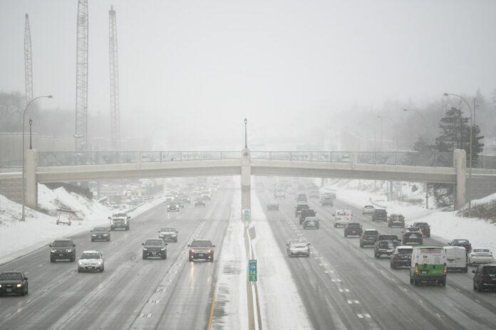
Winter weather alerts spanned the nation on Monday as a dangerous winter storm hit the central U.S., causing the biggest snowstorm of the season for one city.
The National Weather Service (NWS) issued several winter weather alerts for Colorado, Texas, North Dakota, South Dakota, Michigan, Minnesota, Nebraska, New Mexico, Oklahoma, Kansas and Wisconsin. The alerts included a winter weather advisory, winter storm warning and a blizzard warning after a low-pressure weather front developed over the weekend.
Freezing temperatures could dip to 24 degrees Fahrenheit in some areas.
The storm brought heavy snow to several states, including Minnesota, where the biggest snowstorm of the season occurred in Minneapolis, according to an AccuWeather report.
Getty
Snow began falling in Minneapolis on Sunday morning. Since the storm started, more than 8 inches of snow has fallen in the city.
“The airport, as of Monday morning, reported 8.2 inches of snow, making it the biggest snowfall of the season for that location,” AccuWeather Meteorologist Elizabeth Danco said in the report.
The storm is Minneapolis’ biggest this year, beating out the snowstorm on Valentine’s Day by more than an inch. The snowfall at the airport also broke the record for March 24.
However, despite the winter weather, Minneapolis was still only at 55 percent of the historical average for seasonal snowfall before the most recent storm hit.
The wintry weather is expected to continue through Tuesday, although the Twin Cities/Chanhassen NWS office, which includes Minneapolis in its coverage, said that the precipitation will change to rain during the day on Monday.
“Tonight, colder air will move in causing a changeover back to snow and introduce freezing rain. The transition will occur from west to east, with any icing potential on the leading edge,” the NWS said. “This could be tricky for the Tuesday morning commute. A few more inches of snow accumulation are possible.”
NWS meteorologist Caleb Grunzke told Newsweek that there could be some potential for freezing rain or sleet on Tuesday morning, which could further hinder travel. He said the storm will move out of the region by late Tuesday afternoon.
By the time the storm moves out of the region, AccuWeather reported that more than 6 inches of additional snow is expected from southwestern Nebraska up to the Great Lakes. Even more snow, as much as 18 inches, is expected from central South Dakota to northeastern Minnesota and northwestern Wisconsin.
Grunzke said that following the current storm, it’s possible another system could impact the central U.S. next weekend, but it’s still “too early to say” if the storm will bring impacts to the Twin Cities region.
Uncommon Knowledge
Newsweek is committed to challenging conventional wisdom and finding connections in the search for common ground.
Newsweek is committed to challenging conventional wisdom and finding connections in the search for common ground.


