


A huge, glowing river of lava has been snapped from space creeping across the Icelandic wilderness after the recent volcanic eruption on February 8.
The image, taken from orbit by the European Union’s Copernicus’ SENTINEL-2 satellite, shows the stream of lava around ten hours after the eruption began, roughly 2.5 miles northeast of the fishing town of Grindavík.
This eruption marks the third time that the Reykjanes peninsula has seen a volcanic eruption in as many months, having first erupted on December 18, then again on January 14 on the outskirts of Grindavík, which caused the town to be evacuated and several houses to be burned down by the lava flow.
European Union, Copernicus Sentinel-2 imagery
The Copernicus image shows the lava pouring out of the new 2-mile-long fissure in the ground, and flowing around 3 miles to the west of the eruption. It also shows a plume of smoke drifting southwards over the Atlantic, passing above Grindavík.
“The eruptive fissure lengthened both towards north and south during the first minutes. The first images from the Icelandic Coast Guard’s surveillance flight suggest that the eruption takes place at a similar location as the eruption on the 18th of December 2023,” the Icelandic Meteorological Office (IMO) said in a statement on Thursday morning.
“The lava fountains reach about 50-80 m [164-262 feet] height and the volcanic plume rises about 3 km [1.9 miles] above the eruptive fissure.”
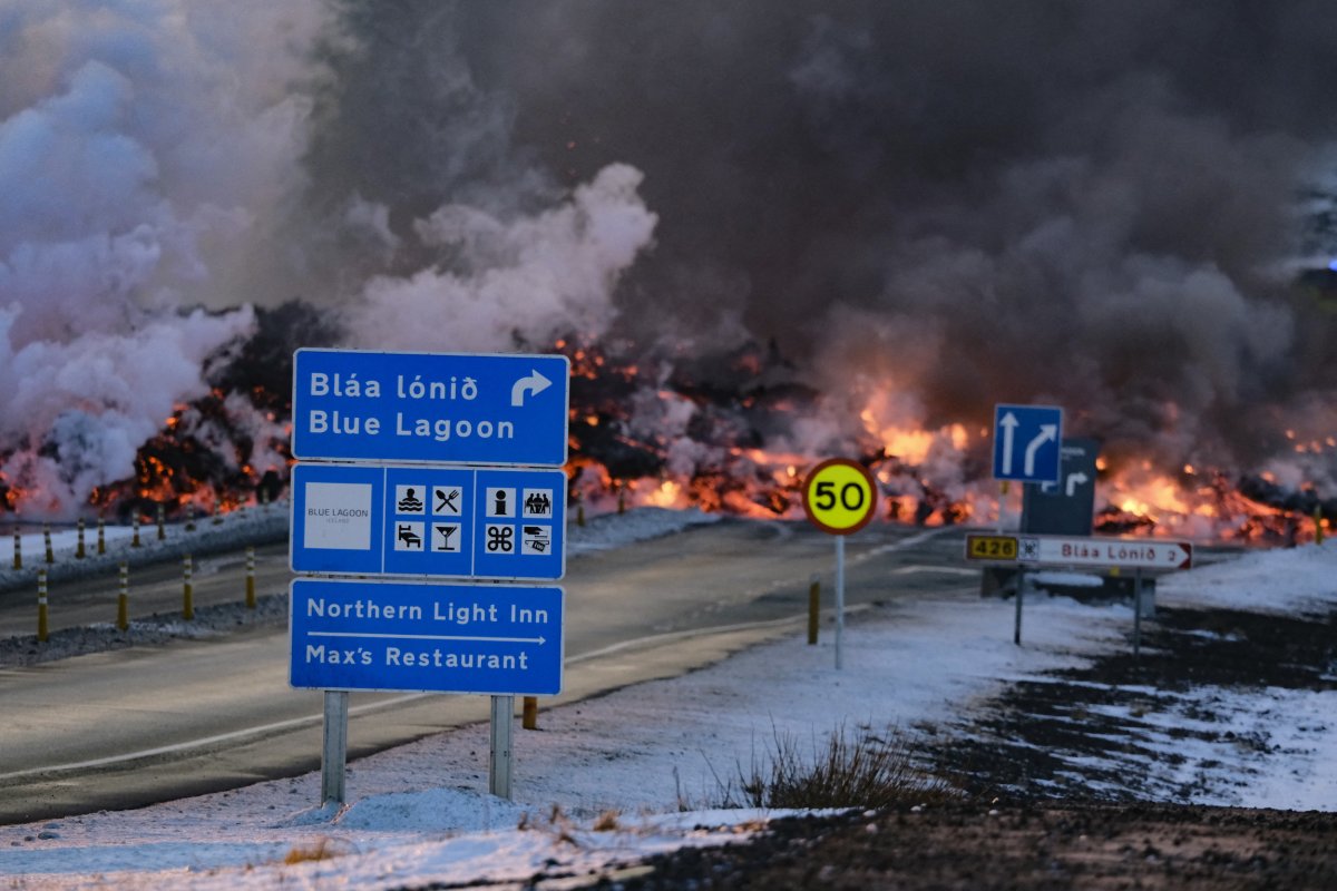
The lava flow crossed a main road near the famous Blue Lagoon and has disrupted the hot water supply to more than 20,000 households across the region. However, as of Friday, this eruption appears to have stopped.
“No eruptive activity was observed in a drone-flight over the eruptive site carried out at noon today (9 February) by the Special Unit of the National Police Commissioner. This suggests that the eruption is ending. Volcanic tremor is no longer being detected on seismic sensors,” the IMO said.
New research recently found the 9-mile-long river of magma below the ground that keeps causing these eruptions was flowing much faster than expected, at around 7,400 cubic meters per second, or 261,328 cubic feet per second. This magma dike is responsible for the new eruptions, with magma seeping up toward the ground and creating new fissures across the Reykjanes peninsula.
KRISTINN MAGNUSSON/AFP via Getty Images
“The creation and emergence of magma from new fissures in volcanic regions like Iceland involve a complex interplay of tectonic settings, magma generation processes, crustal stresses and fracturing, properties of the magma itself, and interactions with external factors like water and ice,” David Kitchen, an associate professor of geology at the University of Richmond, told Newsweek.
“These processes are dynamic and interconnected, leading to the ever-changing landscape of volcanic activity.”
Prior to 2021, the area had not seen any eruptions for hundreds of years, while three have occurred since December alone. While there are no signs of another eruption impending, scientists fear that more may come soon and that the Reykjanes peninsula has entered a new volcanically active era that may last for decades.
Do you have a tip on a science story that Newsweek should be covering? Do you have a question about the Iceland volcano? Let us know via [email protected].
Uncommon Knowledge
Newsweek is committed to challenging conventional wisdom and finding connections in the search for common ground.
Newsweek is committed to challenging conventional wisdom and finding connections in the search for common ground.