


Satellite images show the scale of destruction in the Libyan port of Derna after floodwaters swept away bridges, streets and communities – leaving thousands of people missing or dead.
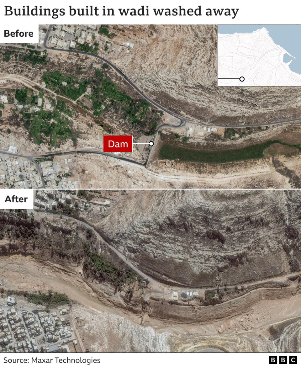
Heavy rains brought by Storm Daniel at the weekend caused two dams to burst on the usually dry Wadi Derna riverbed running through the city. The torrents of water and debris left a trail of devastation.
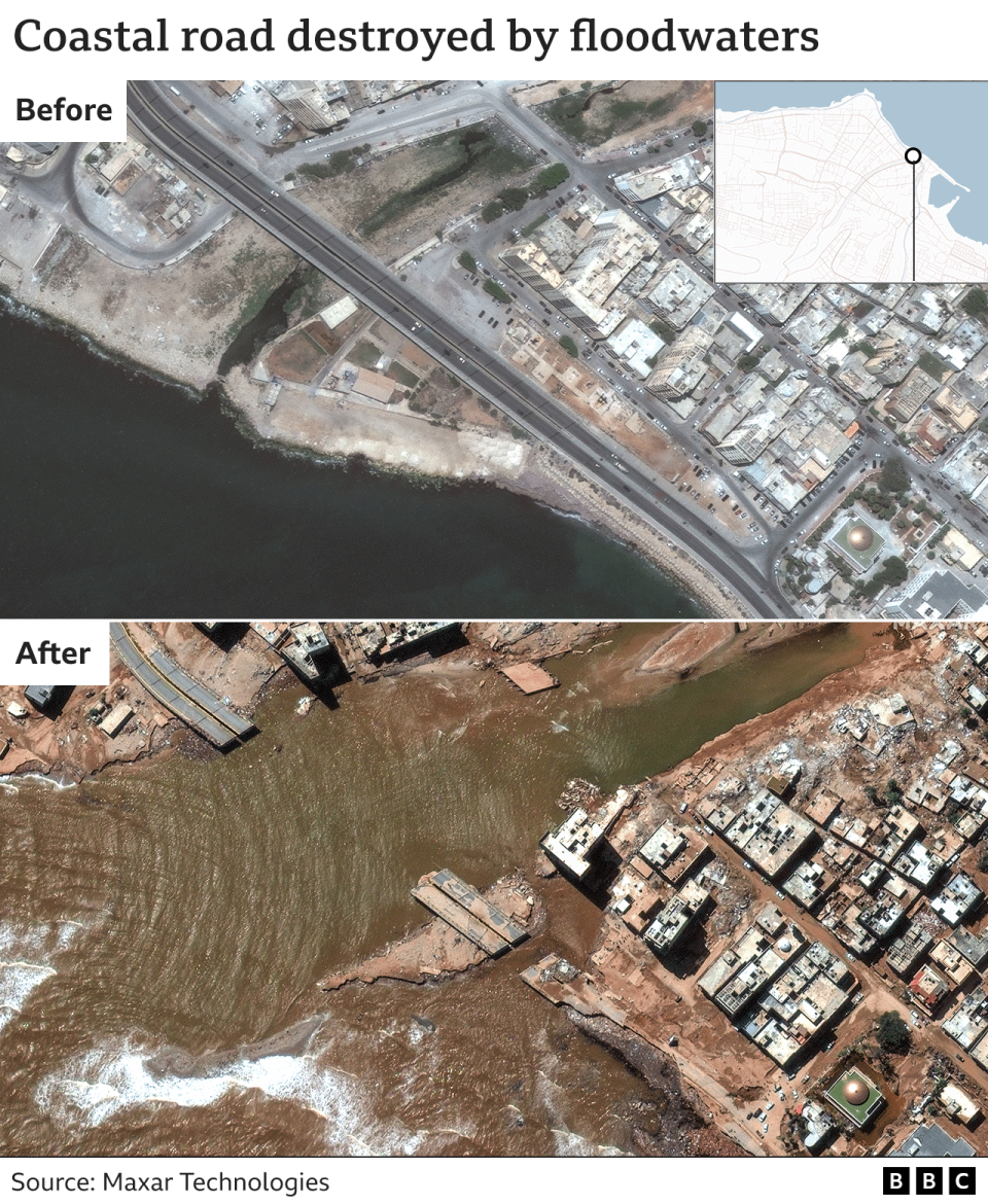
A series of bridges had crossed the wadi, connecting the port area with the western side of the city. The waters – which one official described as ‘like a tsunami’ – swept away the bridges and whole blocks of buildings along the river including multi-storey residential blocks, government buildings and a large mosque.

A major coastal road near the port has been washed away. In the nearby neighbourhood of Al-Eilwa, around 96% of properties were reported to have been flooded.
Derna’s population was around 125,000 before the storm hit Libya. The city’s mayor said that given number of neighbourhoods completely destroyed, between 18,000 and 20,000 people may have died. Thousands are also injured or missing, with many more left without anywhere to live.
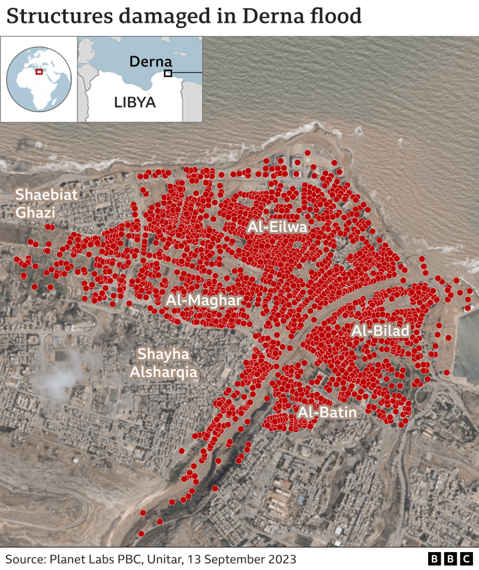
Analysis from Unitar – which looks at satellite images to asses the extent of the damage, says more than 2,200 buildings were exposed to rushing floodwaters and at least six bridges were damaged as well as the port area. Each red dot in the picture above represents one a structure hit by flooding.
Severely affected neighbourhoods such as Al-Bilad and Al-Maghar on either side of the river were also home to healthcare facilities that would be used by people from across the city, according to disaster analysts Reach.
Homes built in the dry riverbed on the sea side of the dam bore the brunt of the flood as the dams burst.
Community facilities, including buildings around Darnes Football Club’s home ground, were also destroyed or covered in layers of mud and debris.