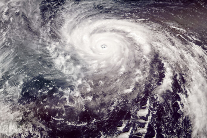
Typhoon Mawar is roaring toward Guam, packing devastating winds of more than 140 mph and a massive storm surge for the U.S. territory, forecasts show.
The typhoon is posing a “triple threat” of heavy rainfall, “life-threatening” storm surge and catastrophic winds equivalent to at least a Category 4 hurricane, the National Weather Service (NWS) Office in Guam shared in a Facebook Live.
In the live video, Landon Aydlett, meteorologist with NWS Guam, urged residents to seek shelter immediately as the storm is expected strengthen as it approaches the Western Pacific island. The typhoon is expected to make a “direct hit” to the island Wednesday afternoon, peaking around 4 p.m. local time, and continue until Thursday. Aydlett, who answered questions about the impending storm during the broadcast, said to remain indoors through Thursday morning and to follow the NWS on social media for further updates.
He said the storm will “pass over much of Guam,” adding there might be periods residents will see breaks in the clouds and a peek of blue skies. However, he cautioned that “is not the end of the storm.”
“Anyone caught outside could be at extreme risk of injury or death,” Aydlett said.
Newsweek has reached out via email and Twitter to the NWS and NWS Guam.
Elen11/Getty
The typhoon recently weakened from Category 5 strength and lost its “super typhoon” status, which requires winds of at least 150 mph. However, forecasters cautioned that it is still possible the storm could increase as the eye approaches Guam.
Aydlett warned that the island will take a “significant hit” from the storm even if it does not ramp up in intensity. Mawar will be Guam’s “first eye passage” in more than 20 years when Super Typhoon Pongsona slammed the island, inflicting $1 billion in damages.
The NWS shared the storm’s path on Twitter, and as of roughly 9:12 a.m. local time, the storm was about 60 miles southeast of Guam.
At 10:30 a.m., NWS Guam said on Twitter that when it issues an extreme wind warning, islanders need to seek shelter immediately.
“We will be monitoring radar data and when 115+ mph winds are anticipated in less than an hour, we will be issuing the Extreme Wind Warning to detail timing & location of these extreme winds,” the weather service tweeted. “If your area is included, seek shelter in an interior room.”
We will be monitoring radar data and when 115+ mph winds are anticipated in less than an hour, we will be issuing the Extreme Wind Warning to detail timing & location of these extreme winds. If your area is included, seek shelter in an interior room. https://t.co/kUCuTWXo6w pic.twitter.com/nTlvUCZZh7
— NWS Guam 🇬🇺 (@NWSGuam) May 24, 2023
Aydlett advised residents to seek shelter in concrete or concrete-reinforced structures. He said he expects severe weather conditions, including deadly winds, to wallop the island. Some areas of Guam could receive up to 24 inches of rain during the storm, which also poses risks of flash flooding and mudslides. Aydlett said he expects “massive sea conditions” with a storm surge of up to 25 feet, which will present a “significant risk” to life and property on the island.
Governor Lou Leon Guerrero ordered a mandatory evacuation of low-lying coastal areas of Guam in anticipation of Typhoon Mawar. The Guam Department of Education has also opened 12 emergency shelters for residents in need.
In preparation for the storm, the U.S. military, which occupies roughly a third of Guam, moved its ships out to sea and aircrafts off the island or in hangars. The roughly 10,000 military personnel stationed there were advised to seek shelter and remain indoors.
President Joe Biden on Tuesday declared an emergency for the territory, which has a population of nearly 170,000, who predominantly live near the coast. The emergency action allows the island to receive federal disaster assistance through the Federal Emergency Management Agency.


